Shop Google Play on the web. Purchase and enjoy instantly on your Android phone or tablet without the hassle of syncing.
Application already with new maps 2014/2015
Cycling-tourist navigation SmartMaps online unlimited and free. You can activate the offline version by sending an SMS directly from the application. By activating the service, you get Cycling Maps of the Czech Republic 1:40,000 and navigation in offline mode.
The service is charged with a subscription of CZK 55/30 days including VAT. Your subscription automatically renews until you deactivate it. Deactivation of the service is possible by sending an SMS in the form: "SMARTMAPS STOP" to the number 90012.
A map and navigation application offering a unique combination of offline maps along with voice navigation along a planned route. It will record and save your sports performances, which you can then export for further processing. The ideal companion for all sports and outdoor activities.
● Enjoy offline navigation in the Czech Republic and Slovakia
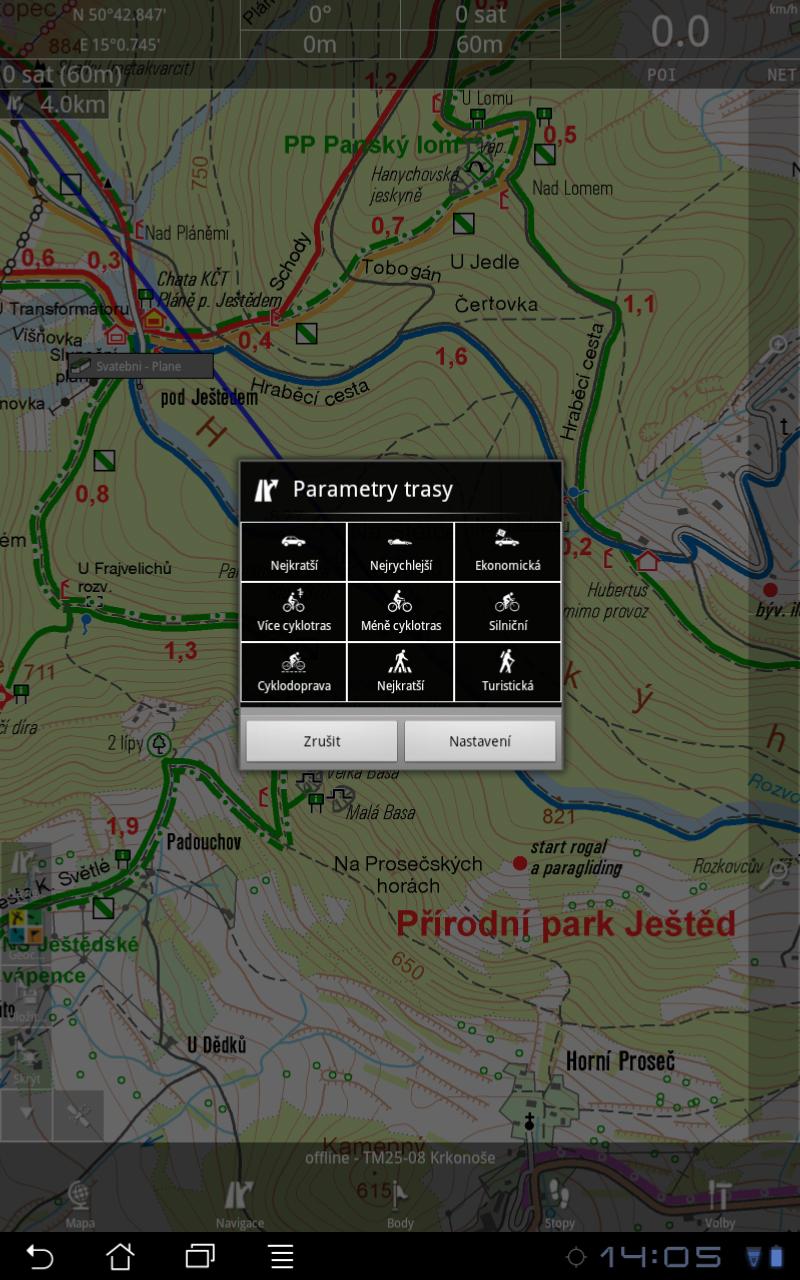
● Plan trips by car, bicycle and on foot along the KČT routes
● Option to choose more/fewer cycling routes, only for road bikes, prefer KČT tourist signs, etc.
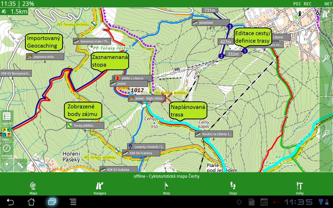
● Import your own routes and waypoints
● Orient yourself according to the most accurate cycling maps
● Hunt for caches
● Save your favorite routes and places
● Record your sports activities
and much more..
Main features of the app:
● Planning of road, cycling and hiking routes
trails (online-free, offline-for purchase)
● Offline voice navigation
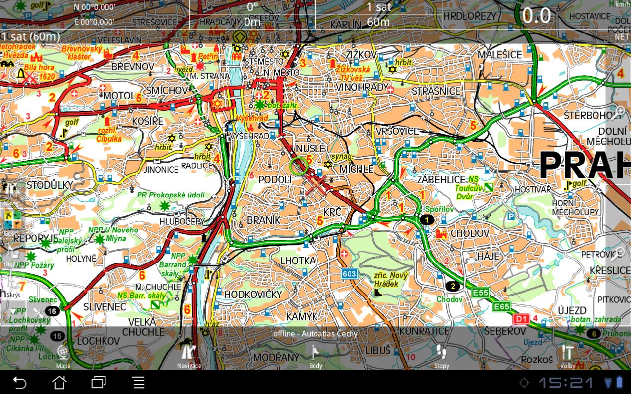
● Online maps (free)
● Offline maps (for purchase)
● PC Manager - desktop extension (free)
● Location on the map (actual position from GPS)
● Search for addresses with descriptive and reference numbers (online world/offline Czech Republic)
● Guidance to the destination (on the map/compass)
● Geocaching (online/offline)
● Recording of tracks with plotting on the map (GPS log)
● 95,000+ points of interest (search, display, find nearest...)
Available maps:
1:40,000 CR (pedestrian, bicycle, tourist)
1:75,000 CR (pedestrian, bicycle, tourist)
1:100,000+ CR (car)
Support:
·All resolutions
Android 2.x, Honeycomb 3.x, ICS 4.0.x, JB 4.x, KK 4.x
·G-sensor, digital compass, internal/Bluetooth GPS
·Capacitance/resistance display
About Seznam.cz, as:
The SmartMaps product uses its own map data or Geodézie On Line, spol. s ro (scale 1:25,000/50,000). It is also a producer of its own planning (routing) data, which enables the release of updates in the shortest possible time (once a month). The development responds to user input and its goal is to be the best map and navigation application on the market.
Read more